 |
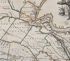
| Figure 3 Detail of the Rappahannock River valley in John Henry, cartographer, Thomas Jefferys, engraver, A New and Accurate Map of Virginia, Wherein most of the Counties are laid down from Actual Surveys (London, 1770). Engraving and watercolor on paper. (Courtesy, Colonial Williamsburg Foundation; photo, Hans Lorenz.) This map highlights and identifies the sites associated with Robert and William Walker. |